By most maritime law, you are required to have some sort of VHF radio if your vessel is over a certain length.
Of course you do. Only prudent, really.
But as I am of a more independent cast of mind, and because the range of VHF radios is pretty short, I like to avoid trouble in the first place. A big part of that at sea is knowing the weather. A large part of knowing the weather is knowing what the barometer says and what it means.
If you sail coastal waters or just daysail, you don't necessarily need more than a cheap barometer that can be calibrated to a known source, like a nearby weather station or airport. By "cheap", I mean those frequently expensive aneroid barometers in brass and glass that go with the anchor-motif throw cushions and the drunken skipper corkscrew. Yes, I'm as guilty as anyone, really.
Keep in mind, however, that any barometer that is working (if not super-accurate) requires calibration, and that if you are inland or Great Lakes sailing, you have to calibrate your barometer to the local altitude. Some sources report "sea level pressure", which is not the pressure on the Great Lakes, nor is it up the side of a hill somewhere. Sailors in Alberta lakes could be any number of feet above sea level, rendering an airport's broadcast "sea level" readings opaque to say the least.
For those who for reasons of personal interest, expanding their seamanship, or because they are going to be sailing long passages without being able to receive info from weather buoys or synoptic charts, a recording barometer becomes very helpful. This can be analog or electric, paper roller (old style and blindingly expensive, but gives you a graph more or less continuously over a week's time, usually), or digital display.
I have aboard a now-discounted Speedtech barometer: http://www.landfallnavigation.com/-neb01.html
It gives me 24 hours of readings, which is enough to track weather at a distance as well as weather that's bearing down. Basically, sharp drops or sharp rises portend wind (not always true, but frequently the case); high pressure means light winds, fair weather, and low pressure can mean dirty weather or just rain. Knowing the speed at which the pressure is changing can, with experience, tell you how near or far a storm is, how fast it is likely moving, and whether it will push the boat nicely, or is a reason to batten down.
I also have a Suunto sports watch that has a recording barometer display with a three-hour trend interval, although I can manually record readings at any point. I use this frequently during periods of changeable weather to determine if it is likely to rain by a certain point in the near future. Practise and you can get better than the weather people, but only in a local sense.
Combine these instruments with looking at clouds, currents, sea state and so on, and you are essentially a one-person weather station with maybe a 50 square mile "forecast area". This is not always necessary if you can receive local or "custom" forecasting...but forecasting is an educated guess, and you are the one actually in the weather.
I recommend any sailor, even the lunch-hook crowd, to take a weather course or two to understand and in even a small way to predict your sailing weather. That big black cloud could be a great sailing opportunity or a run on your candied ginger supplies, but isn't it better to know?
Recommended reading for Canadians: http://www.starpath.com/catalog/books/1829.htm
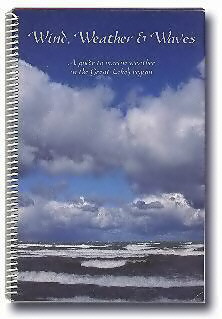
It's a short, heavily graphic, wire-bound booklet focusing on Great Lakes-typical weather, but which has very solid advice for all sailors. It's possibly the best government-written publication I've ever seen that wasn't just a list of buoy types!