 |
| Science can be beautiful, particularly when it reveals where the good wind is at. |
Who has seen the wind?
Neither I nor you:
But when the leaves hang trembling,
The wind is passing through.
Who has seen the wind?
Neither you nor I:
But when the trees bow down their heads,
The wind is passing by.
Some of the weather junkies reading this...and if you are reading this, some of you are likely amateur meteorologists...may recall my 2012 post on a little bit of coding that revealed North American wind patterns.
 |
| Hurricane Sandy, from October, 2012. |
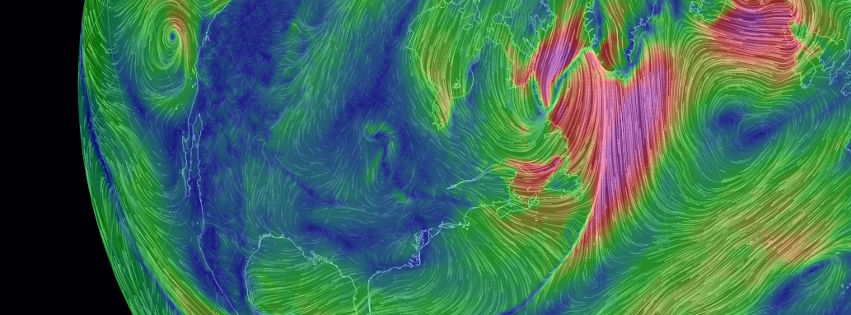
Well, apparently that art project has inspired a rather more robust effort that I can see as being very, very useful for the sailor planning passage routes. The rather prosaically named Earth Wind Map is both clearly inspired by the previous project, and yet is very much more comprehensive. The coding effort of just one fellow, the gifted Cameron Beccario, the site is useful both as a observational tool of current barometric and wind conditions at the surface, but of conditions higher in the atmosphere, particularly at the 500 mb level, analysis of which can be an excellent tool for the sailor to predict her future weather at the surface.
 |
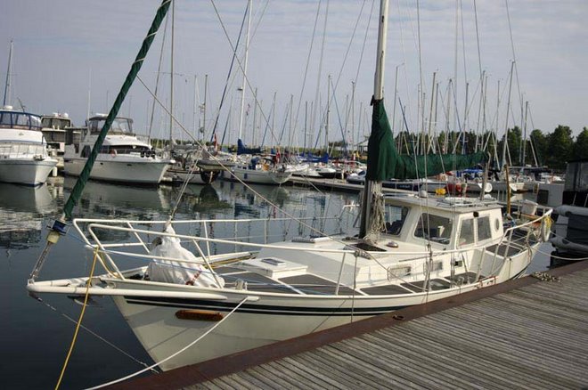
| Read the book, see the level! |
 |
| I'm just enough of a weather geek to get excited by pictures like this. |
Now...clearly...a site like this is no replacement for either professional weather forecasting or the practised efforts of for-hire cruiser forecaster and route planners. But the reality of modern cruising is that it's the skipper on the ocean who is responsible for the final determination of where the boat will point and how it should be prepared for whatever weather should befall the vessel. Tools such as the Earth Wind Map are a visual aid to understanding the surface and 500 mb charts issued by weather agencies, and which are key to understanding from where and at what strength the wind and waves are most likely to come, and which will help or hinder the little boat on the seas.
if you are a sailor who has figured out the various synoptic chart presentations, or are a sailor who is trying to learn them, it's akin to when Dorothy leaves behind monochromatic Kansas for technicolour Oz. So this incidentally beautiful website can stand alone as a merely pretty thing, but its utility to those already able to read these sort of representations seems to me to be high indeed.
Thanks to regular reader John C. for bringing this interesting site to my attention, and to Christina Rossetti for the poetical inspiration of this post's title.
UPDATE 13.12.19: Apparently, this site's getting popular. A leading local radio host just tweeted about how 'hypnotic' the visuals were. It's even better if you can read those graceful lines.
UPDATE 14.01.10: I stumbled across an interesting story that covers off how the jetstream (which of course can be seen with the Earth Wind Map set to the 250 hPa level at which the jetstreams blow) can work to bring Arctic air significantly southward (as has been the case lately), or, presumably, Antarctic air northward.
A video embedded in the article gives a lucid and easy to follow explanation of how the jetstream works and how it's been changing.