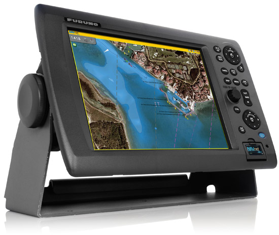
Advances in chartplotting technology in particular and navigation electronics in general are coming thick and fast in the recreational boating world. AIS that IDs distant ships and shows vectors; broadband RADAR that makes fewer amps see farther and better; 3D chartplotting displays that resemble flight simulators; FLIR displays that allow night vision that would shame a cat...it's all available in a bewildering array of standards, and an evolving array of hook-ups. The much-touted NMEA 2000 looks good, but there's still proprietary networking. All require the addition of large amounts of money, and all vie for the attention of the person at the helm.
To me, it seems a bit of a conspiracy to fulfill on the deck of a sailboat the childhood dreams of middle-aged men to fly spaceships. There's certainly an element of this in the ads: "bigger display", "faster refresh", "multi-function overlay" and "depth like you've never seen before". I mean you don't have to page Cap'n Freud: he's rafted up alongside contemplating your massive upgrades.
Now, if you are a voyager or just an aspiring one, you are probably aware that time spent at the wheel or tiller actually steering the boat is relatively low. I would say that on passage, 95% of helming is in fact autopilot or windvane, and that the 5% of active steering is in waters where you either have nav aids, bearings or other information. This is why I contend that a chartplotter at the helm is equivocal at best and a distraction at worst. The new ones are crowded with information, but with no guarantee that the information is particularly current or even accurate, as the chart datums from which the chartplotters derive their information can be stale or, if the area hasn't been surveyed for some time, "off". Many a glance at a radar display confirms that some plotters show land where it isn't, and vice-versa.
It's more prudent, perhaps, in such cases where one is approaching a tricky pass or a complex entrance to a rocky harbour, to advance slowly and in daylight to confirm the waypoints, visually identify the nav aids (if even present) and to manually confirm the daymarks or the bearings to certain features that are most likely not to have moved since the map was made. Oh, yes...have a map. You need it to plan a lot of this stuff ahead of time in order to approach Terra Nova. Who wants to discover "hey, the plotter says there are coral heads 200 metres ahead...CLUNK...SCRAPE..." Better to plan an approach, maybe plot a couple of bearings on a scrap of paper, and then send a crew forward or up the mast to look for stuff Captain Cook missed, or which has grown or sunk in place since Darwin's shipmates heaved a tallow-tipped lead line.
Overreliance on chartplotting
Before you picture our boat rigged with chip logs at the taffrail and the young lad swinging the lead at the chains, I do feel that a 12VDC outlet or two at the helm is very useful. You can rig a light to illuminate the sails or see awash objects in the water, and you can put in a handheld GPS for lat/lon, XTE and heading, which is quite helpful to determine set and drift, currents and ETA to waypoints (set, of course, sensibly away from one's visual target, like a nav aid). The information given is essentially text and minimal graphics (like a grayscale compass), and "the lack of shiny" means that one's attention stays on the environment and the boat instruments, with the GPS being purely supplemental. You keep a watch, not a watch of the GPS itself.
A chartplotter's best use is to help you integrate the sometimes partial clues from the environment and can provide a context. This plus a paper chart can fairly accurately help you to find yourself even in poor visibility, when the object isn't blasting in a straight line directly to the mark or to the port, but by giving obstacles you can't actually see a wide and safe berth.
People driving straight into jetties, breakwaters and buoys (or driving right onto the beach or rocks in some cases) is a function of taking the technology as gospel when really it's just crib notes for a paper chart, and maybe not even an updated one. Lessening the likelihood of getting truly lost is only part of prudent seamanship.
Recently, I read a discussion about the need "these days" to have a magnetic compass at the helm. What's the point, some were saying. GPS is more accurate and I don't have to deal with variation, deviation and keeping metal away from it.
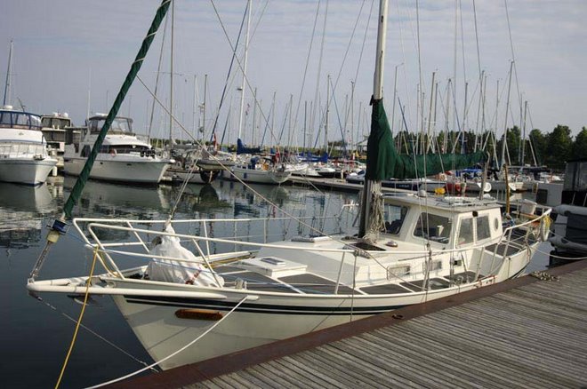
We were lucky enough to have bought, along with the boat, a large Ritchie Globemaster with compensator balls (go on, get the jokes out of the way early) at the pilothouse helm of our steel cutter. I also have a rudimentary plotter there (a Raymarine 420 with no cards, so I use it like a big GPS), and a KVH AC103 fluxgate compass.
At the outside helm, I use a handheld GPS. Eventually, I will probably have a small plotter out there so I don't have to squint...but that will be mainly for GPS-type functions. Most "inshore" helming will be done from inside the pilothouse, just as most mooring/anchoring/docking helming will be done from the outside, so signals can be given and surrounding traffic better seen.
While I currently sail in Lake Ontario, where the need for advanced navigation is seldom, I do use all of my little array of gadgets about equally in conjunction with paper charts. I usually have a bearing in mind and a glance at the helm compass (the accuracy of which I know and the deviation of which is small due to those pair of manly shotputs) is a quicker, more intuitive confirmation of general heading than the GPS, or so I find.
Just as with my sextant practice, sometimes I will shut down all the electronics and work from DR plots, magnetic compass bearings and, particularly, soundings in order to verify my position at night or in fog. The point of having these pre-electronic devices and techniques is not that they are critically necessary, but that you still know how to use them if they become so, for instance during a complete electrical failure. I have yet to install an autopilot, and when I do, I will likely update the fluxgate compass to provide it with heading data.
My experience with GPS has included two episodes when what I was reading was obviously, even blatantly wrong: One time was when I was at a known, charted physical waypoint that I had recorded before (and which was correct on the chart) and the GPS reported that we were just over a mile off (it corrected some ten minutes later), The other was when I was using the GPS for COG and speed, not lat/lon, and my six-knot speed jumped for a few seconds to 60 knots and my lat/lon magically ended up 3/4 NM WSW of my assumed location.
These were using different GPSes. Obviously, "the system" is prone to technical hiccups or tweaking from the ground stations. A little investigation of the subject revealed that the "constellation" of GPS satellites is both aging and subject to failures from such natural events such as solar flares or even atmospheric drag (the atmosphere can expand due to heating and can "drag" at the satellites, requiring recalibrations). Also, some of the damn things are decades old and can't have uninterrupted up-time, or so it seems. Fair enough...I didn't pay for the things.
So while GPS is indeed a blessing, I keep the compass handy, visible and in good working order. Intrinsically, unless I go into the Southern Hemisphere or sail over a unknown magnetic anomaly (many are charted and it's fun to sail over some giant chunk of iron just to watch the compass spin), the compass is less failure prone than either the GPS reliant on ship's power or batteries, or the GPS system which needs periodic adjustment. I say this advisedly because reading the compass requires training and practice and knowledge of when it might not be accurate and why this might be. Grasp those aspects, however, and you too can be like Captain Bligh (not the best people person, perhaps, but a hell of a navigator) and steer with confidence to a reliable bearing.
Also, despite political statements to the contrary, don't think that the military of the U.S. will not turn the GPS system off (at least to civilian use) or make it less accurate if needed. It isn't actually for we sailor types: it's to aid one particular military establishment and their goals are always going to be concerned with finding the mooring before sunset so drinking may commence. Its use in several thousand civilian applications would very likely be deemed trivial in some kind of military crisis. Other GPS sources will eventually exists, as will devices able to read them, but today it's still the Pentagon's plaything, and assuming it will always be working as expected is perhaps a limiting strategy.
As a third party can't "turn off" the stars and the magnetic poles of the Earth (yet), I choose to keep my CN and pilotage skills in order, and that means a lot of peering compasses and plots on paper. I find the electronics make a nice back-up and a nice way of "looking down the road" to plan one's next steps, but I hesitate to place my self-interest and safety in something so easily crippled from either bad crimping on my end or unseen machinations at the other.


